Route 66 Centennial Camping Guide (2026): The Official Story and How to Camp Along It
U.S. Route 66 was established on November 11, 1926. The 2026 centennial year runs the length of the old road from Chicago to Santa Monica. Here's the official background, and how to camp on public land without treating the highway as a campsite.
🖨 Print this how-to One-page checklist, no ads.
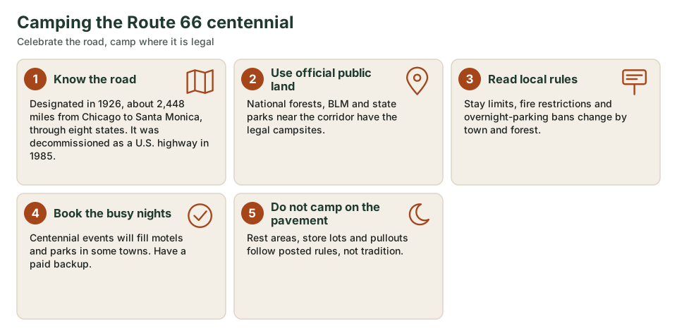
Quick answer: Route 66 was designated on November 11, 1926, and runs about 2,448 miles through eight states. The 2026 centennial is a year-long commemoration. Camp on official public land or in paid campgrounds near the route; the highway itself, and most town lots, are not a campsite.
The Mother Road is a historic corridor, not a BLM open camping zone. Plan the driving and the camping as two different tasks.
What 2026 commemorates
Congress found, in the Route 66 Centennial Commission Act (Public Law 116-256, December 23, 2020), that 2026 is the centennial anniversary of Route 66 and created a commission to recommend federal commemorative activities. Official centennial materials from the Route 66 Road Ahead Partnership describe a year-long observance, January 1 through December 31, 2026, along the historic 2,448-mile corridor from Chicago, Illinois, to Santa Monica, California, through Illinois, Missouri, Kansas, Oklahoma, Texas, New Mexico, Arizona and California. The road was established on November 11, 1926. It was later decommissioned as a U.S. highway, in 1985, and many segments are now marked Historic Route 66.
Camping is beside the road, not on it
There is no special 2026 exception that lets you camp in highway pullouts or town lots. Use national forests, BLM land, state parks and private campgrounds, and follow each area's stay limits and fire rules. BLM's national camping page is the starting point for long-term and dispersed rules on those lands.
How to use this series
State-by-state notes follow in the next guides, with official sources for the public land that actually sits near the corridor. For overnight parking in towns, see overnight parking along Route 66 and the free overnight parking topic. For a day-by-day plan, see how to plan a Route 66 camping road trip.
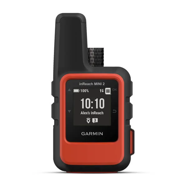
Garmin inReach Mini 2
A pocket satellite communicator for two-way messaging, location sharing and interactive SOS where there's no cell service.
- Messaging
- Two-way text via satellite
- Emergency
- Interactive SOS
- Navigation
- TracBack routing, digital compass
- Service
- Active satellite subscription required
Printable checklist: centennial trip, first pass
- Mileage and eight-state order confirmed (Chicago to Santa Monica)
- Public-land or campground nights sketched before motel-only gaps
- Current fire restrictions and stay limits checked
- Event weekends in 2026 noted, with paid backups
- Overnight-parking rules in towns treated as local, not historic
Frequently asked questions
Is Route 66 still a U.S. highway?
No. It was decommissioned in 1985. You follow Historic Route 66 signs, state roads and sometimes I-40, not a single modern U.S. 66 shield the whole way.
Are there official centennial campgrounds?
The commemoration is for the highway and its communities. Camp in ordinary official sites and campgrounds, and book early around event weekends.
How long is the road?
Official centennial materials use about 2,448 miles from Chicago to Santa Monica.